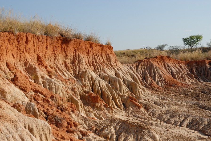
Deep investigation and exploration
Mining and Oil Exploration
STRATAGEM974 designs, organizes and carries out large-scale geophysical exploration campaigns to characterize the location, geometry and potential of underground deposits.

Investigation objectives
Our team of engineers and researchers specialized in geosciences designs, organizes and carries out large-scale geophysical exploration missions to define the location, geometry and potential of underground deposits of precious metals or oil.
Methods used
These investigations are based on non-destructive geophysical methods, including 2D/3D electrical resistivity tomography, induced polarization surveys to study ground chargeability, and large-scale magnetic prospecting.
- Identification of areas with mining potential.
- Mapping of deposit extent.
- Definition of relevant locations for exploration drilling.
- Assessment of deposit potential from a limited number of boreholes.
- Optimization of mining operations.
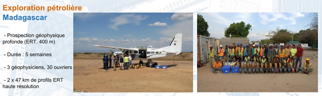
STRATAGEM974 also specializes in deep electrical resistivity tomography measurements, between 400 and 800 m, using surface-based arrays and specifically designed acquisition protocols.
Documentation
Download our brochure: Mining ExplorationNoise, vibration, dust and electromagnetic waves
Nuisance Measurement and Monitoring
STRATAGEM974 performs nuisance measurements and monitoring in order to assess the impact of construction works, facilities or activities on their environment.
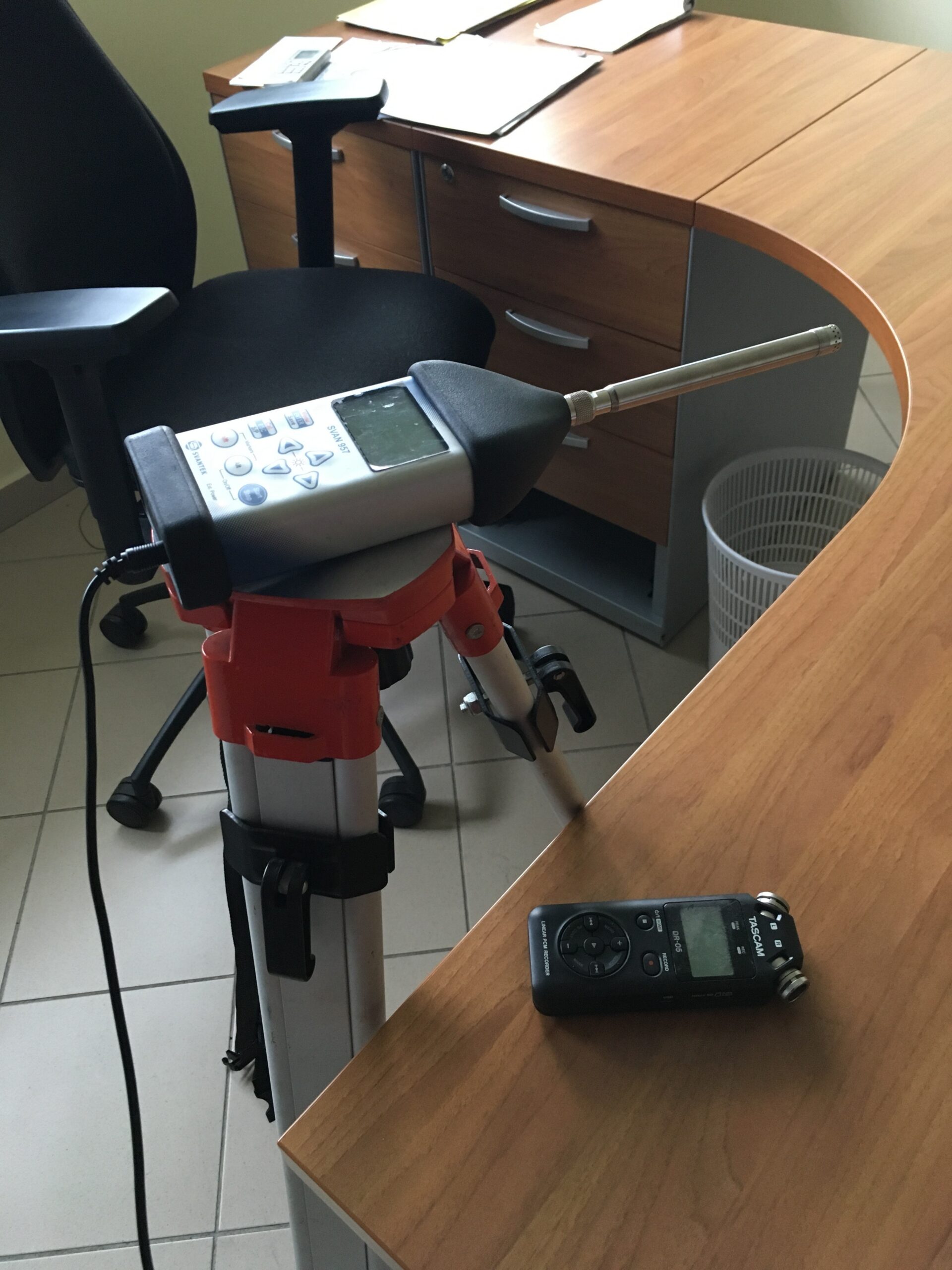

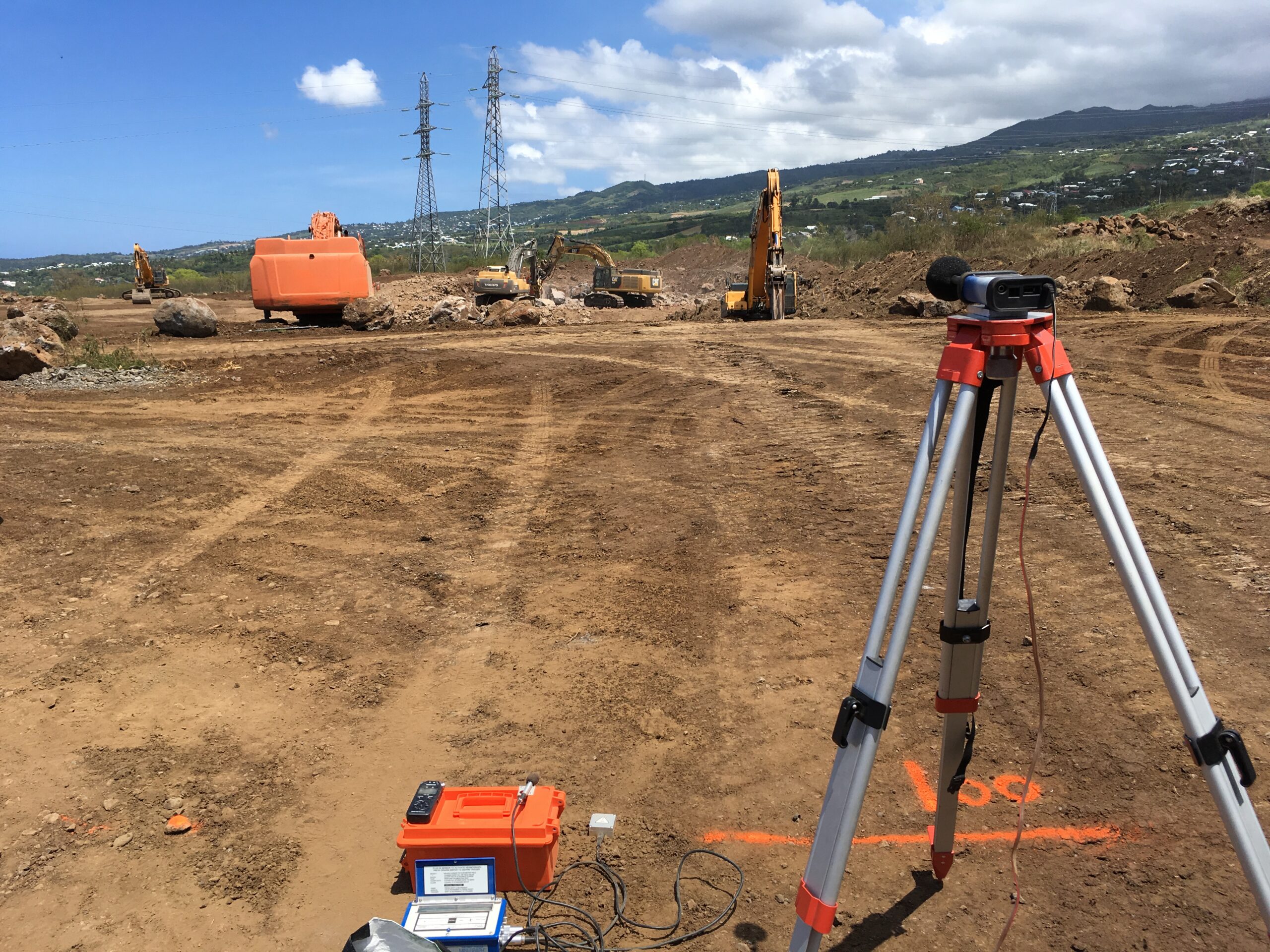
Noise
French regulations impose increasingly strict standards regarding noise levels, whether for noise emitted by vehicles, industrial facilities or acoustic insulation in buildings.
Our team performs sound level measurements in accordance with applicable standards, using precision equipment, including class 1 sound level meters.
Vibration
During public works, vibrations generated by construction machinery can affect nearby structures: residential buildings, civil engineering works, pipelines or sensitive equipment.
STRATAGEM974 sets up continuous vibration monitoring using a network of sensors, in order to prevent threshold exceedances and contribute to the safety of workers, the public and structures.
Dust and electromagnetic waves
We also provide indoor and outdoor air quality monitoring services, particularly for workers’ exposure to dust on construction sites, as well as measurements of exposure to electromagnetic waves inside buildings.
Buried and embedded utilities
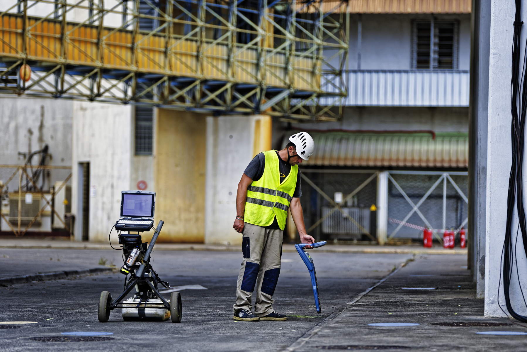
Underground Utility Detection
STRATAGEM974 performs non-destructive detection of buried utilities under roadways or embedded within structures, in order to secure works and reduce the risk of incidents.
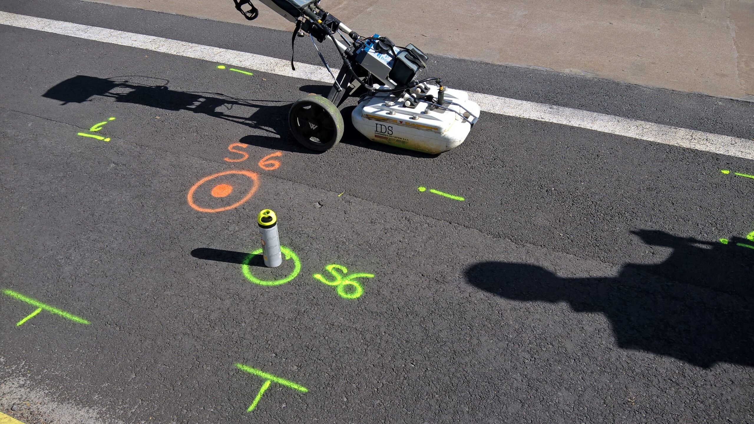

Securing works before intervention
The installation of new infrastructure, such as optical fiber, high-voltage cables or pipelines, is often carried out in areas already occupied by existing underground networks: electrical cables, telephone networks, water pipelines or other buried structures.
Despite the existence of utility plans and preliminary declarations of works, many accidents still occur due to insufficiently accurate or outdated information.
Our services help to
- Locate buried or embedded utilities before works.
- Reduce the risks of electrocution, water service disruption or telecommunication outages.
- Update as-built drawings.
- Improve the safety of workers and users.
Certifications
STRATAGEM974 holds the certification for detection and georeferencing of buried utilities, issued by CCTA, mandatory under the regulations in force since January 1, 2018. The engineering office also holds the QUALIFNEDRE qualification issued by FNEDRE.
Non-destructive structural assessment
Structural Diagnostics
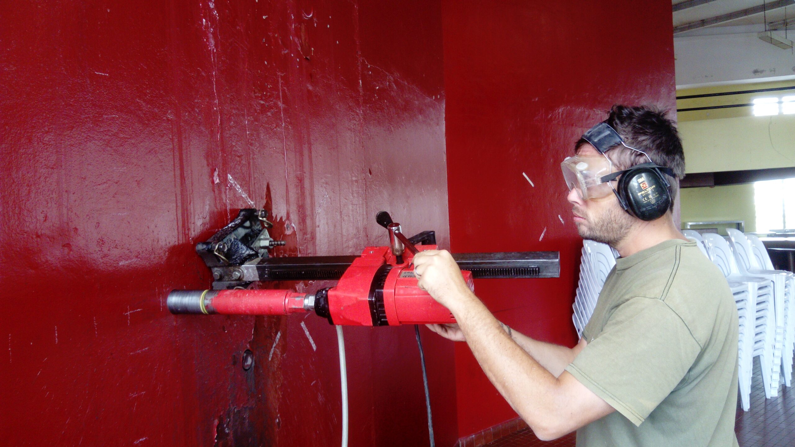
STRATAGEM974 performs non-destructive structural diagnostics of reinforced concrete structures in order to assess reinforcement, thicknesses, internal defects and the condition of structures.
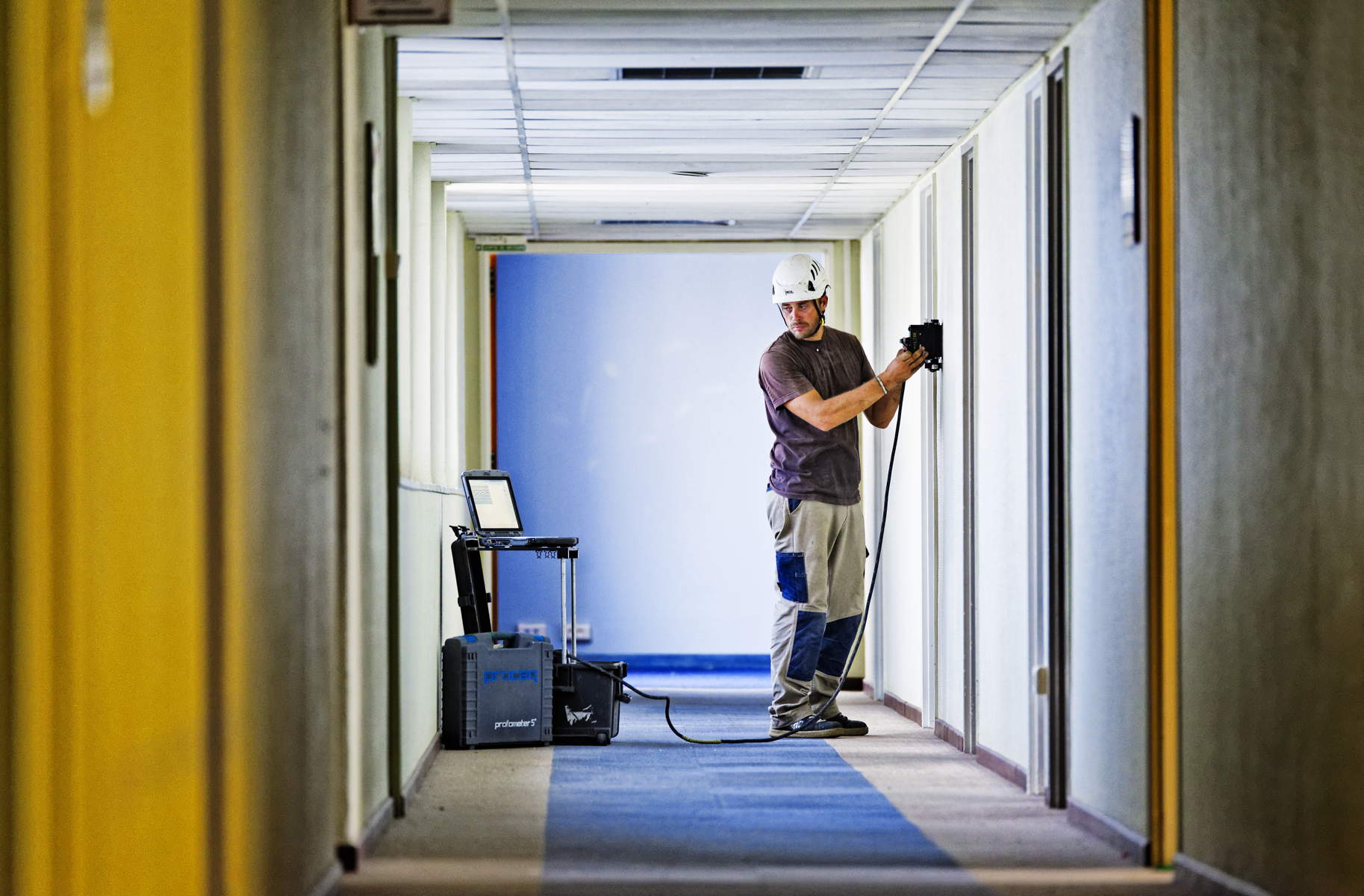
Diagnosis of reinforced concrete structures
We perform non-destructive structural diagnostics of reinforced concrete structures in order to assess the position, spacing, concrete cover and diameter of reinforcing bars.
Applications
- Identification and description of load-bearing structures: buildings, bridges, slabs, beams and columns.
- Assessment of steel reinforcement condition: corrosion and concrete carbonation.
- Quality control of completed works: concrete cover, rebar diameter and mesh layout.
- Detection of cavities, internal defects or degraded zones.
These measurements are non-destructive and can be performed on all types of reinforced concrete structures. STRATAGEM974 also provides additional services such as core drilling, compression tests and foundation investigation surveys.
Sensors, acquisition and monitoring
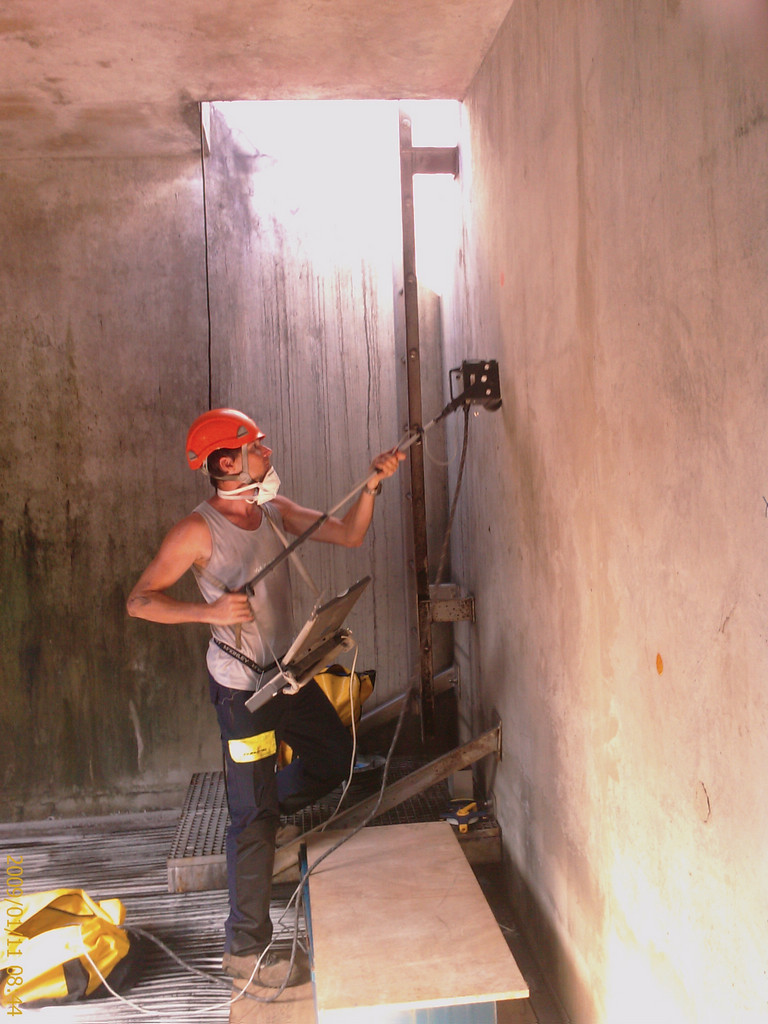
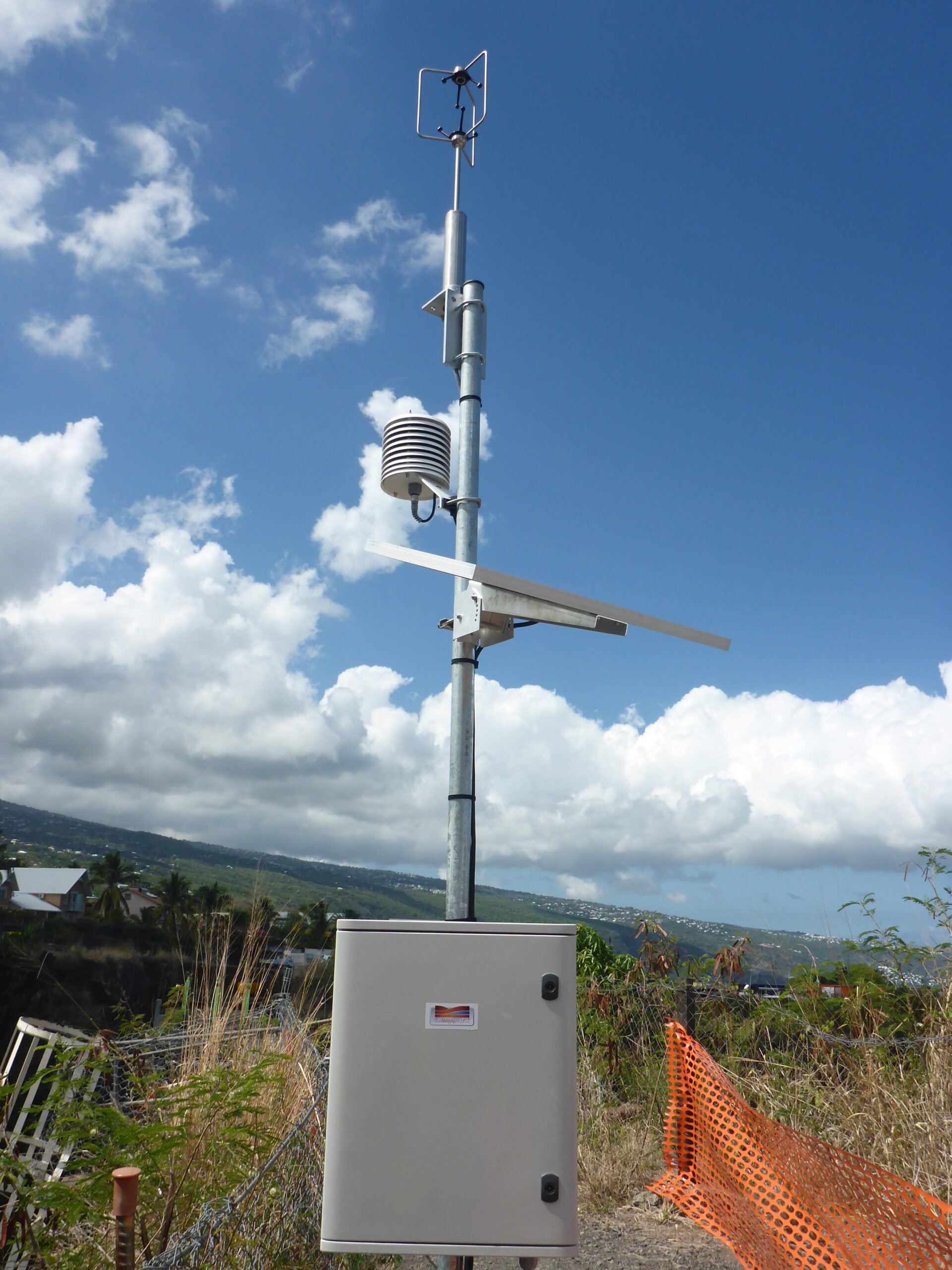
Instrumentation
STRATAGEM974 advises, designs, supplies and installs robust measuring instruments for scientific research, industry, engineering structures and sensitive sites.


Turnkey solutions
We develop, supply and install turnkey solutions for measuring environmental, climatic, hydrological, volcanic or oceanographic parameters on all types of sites.
Fields of application
- Measurement of environmental parameters: climate, hydrometry, volcanology and oceanography.
- Assessment of solar or wind resources for production sites.
- Noise and vibration monitoring.
- Monitoring of deformations affecting civil engineering structures, buildings or rock masses.
- Underwater prospecting: archaeology, wreck detection, cables, ROVs and sonars.
Official representations
STRATAGEM974 is the official representative of Campbell Scientific® in the Indian Ocean region, and also provides solutions from specialized manufacturers such as GILL Instruments, JW Fisher, MadgeTech and Svantek for consulting, supply and installation of precision measuring equipment.
Soils, groundwater, environments and resources
Environmental Studies
STRATAGEM974 applies its geoscience expertise to a wide range of environmental, regulatory, pollution and natural resource studies.

Regulatory studies
- Regulatory files: Water Law, public utility declarations.
- Preparation of ICPE files for classified installations.
- Environmental assessments and impact studies.
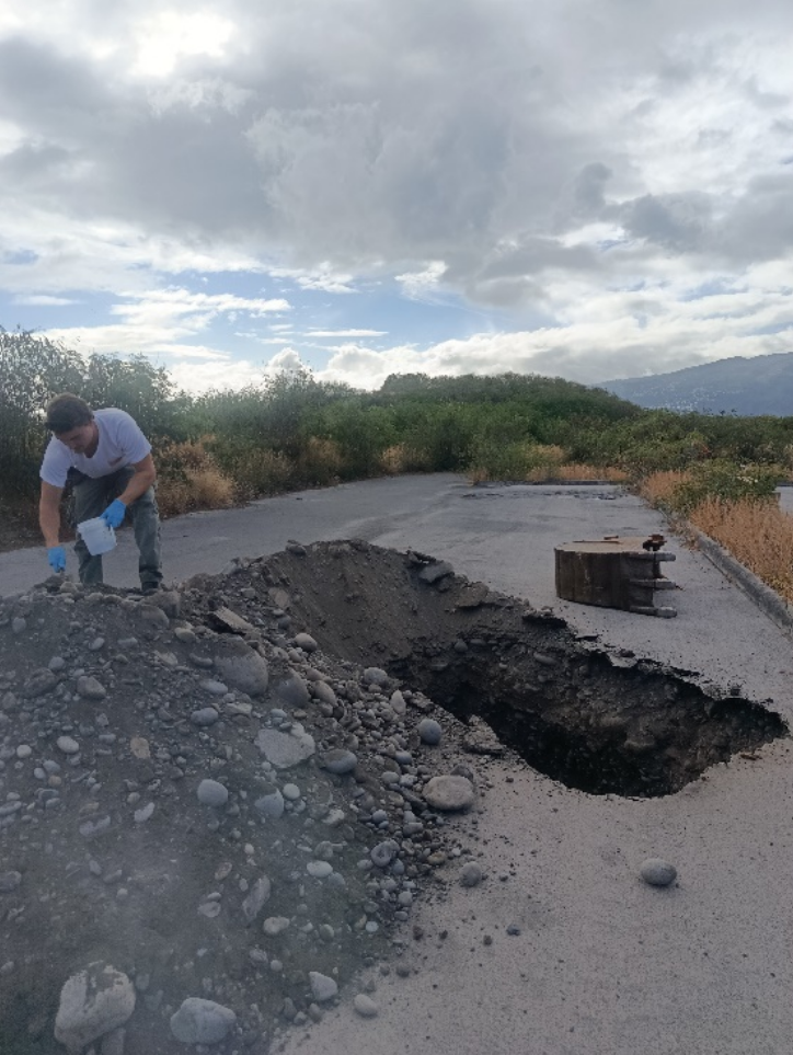
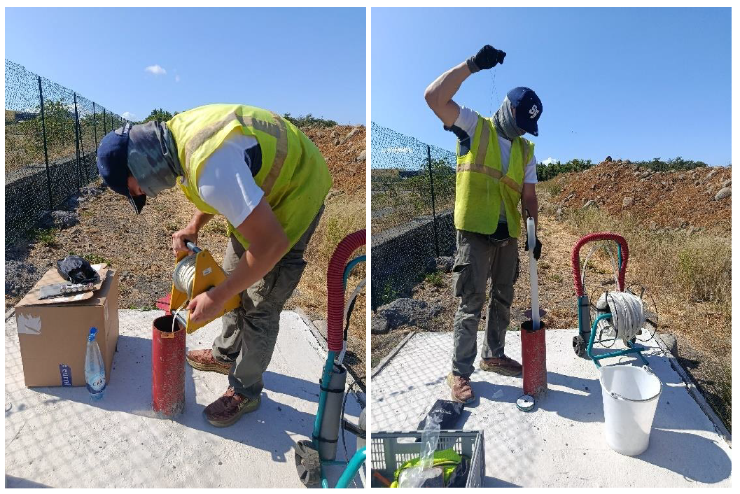
Sampling and pollution diagnostics
- Water, sediment and soil sampling.
- Analyses carried out by COFRAC-accredited laboratories.
- Pollution diagnostics on industrial sites, landfills or rehabilitation sites.
- Management plans and environmental monitoring.
Natural resource exploration
Our team also works on drinking water exploration, deep geothermal targets, exploitable materials, and the performance or interpretation of pumping tests.
Non-destructive subsurface imaging
Geophysics
STRATAGEM974 carries out non-destructive geophysical surveys to determine the geological properties of the ground and address issues related to civil engineering, natural hazards, resources and scientific research.
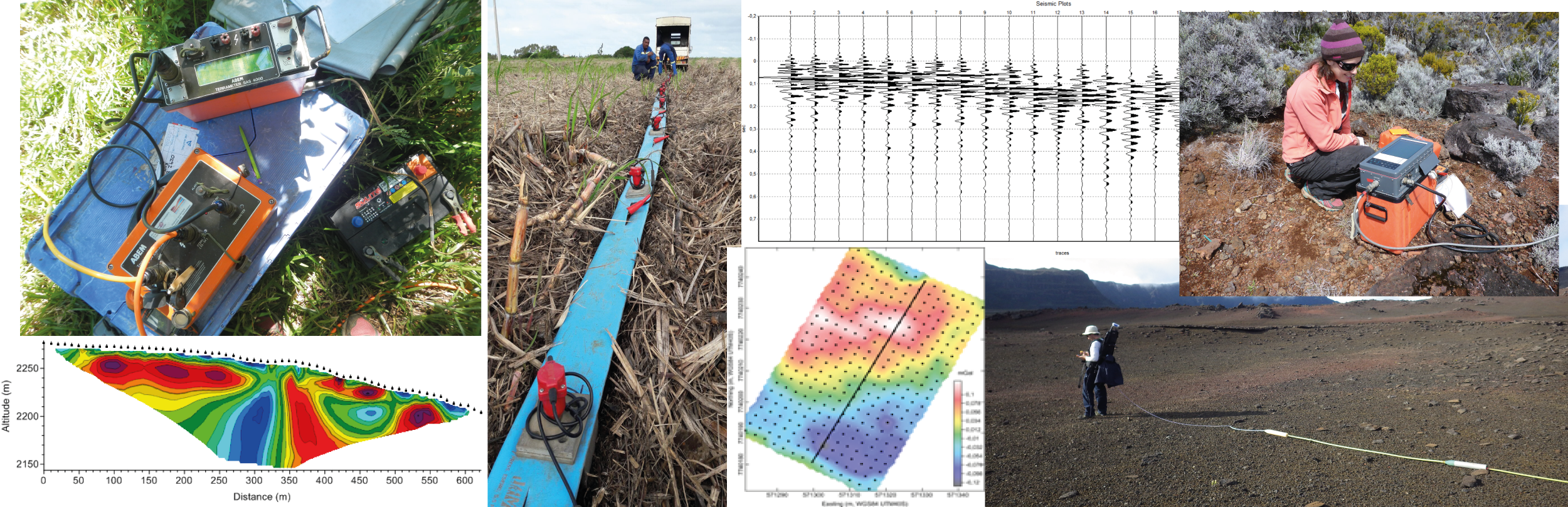
Fields of application
- Civil engineering: cavity detection and assessment of ground mechanical parameters.
- Natural hazards: landslides, faults and discontinuities.
- Natural resources: aquifers, massive rocks and geothermal targets.
- Scientific research: volcanology and seismology.
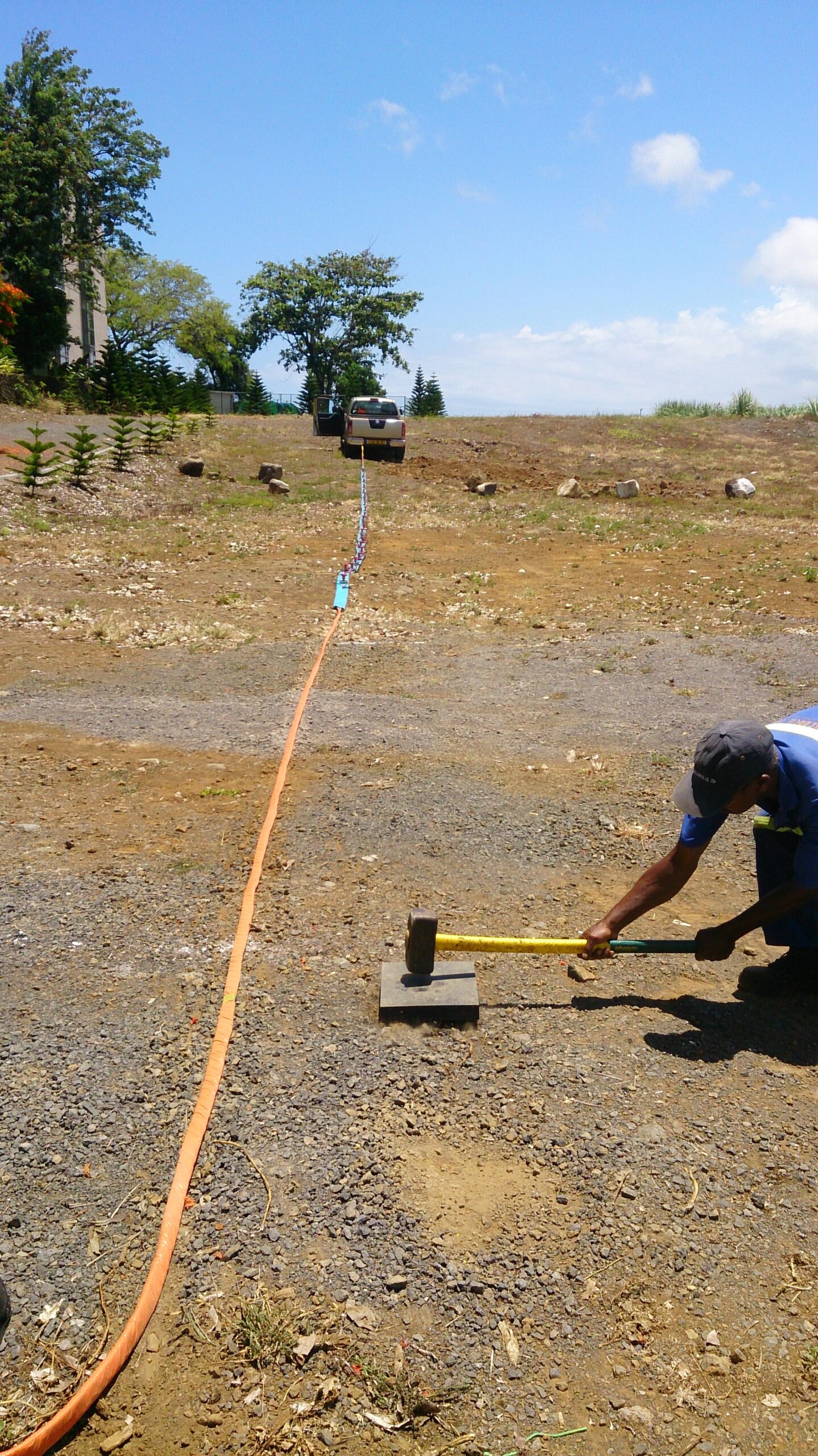
Methods used
- Electrical resistivity tomography and electrical soundings.
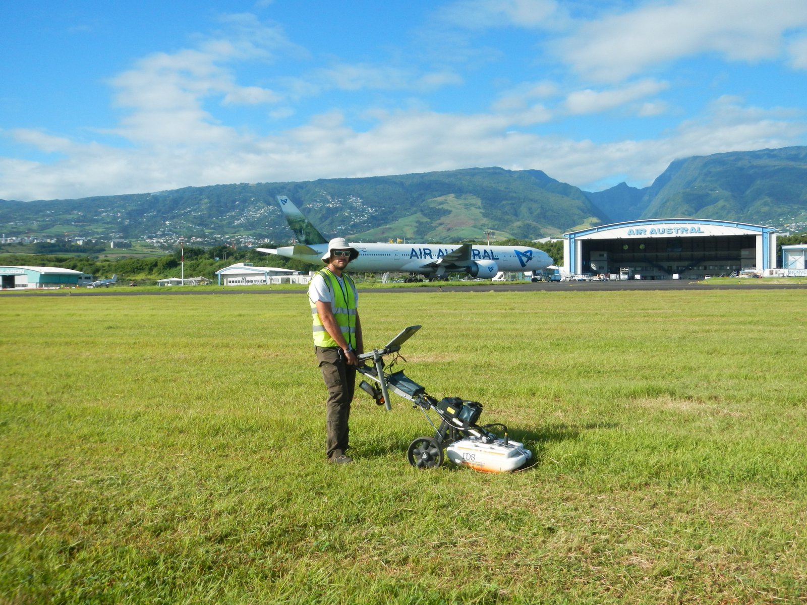
- Seismic methods: MASW, refraction, down-hole and cross-hole surveys.
- GPR: Ground Penetrating Radar.
- Self-potential.
- Magnetics.
Quality approach
STRATAGEM974 is a member of College A of the AGAP Qualité association, which promotes a high-quality scientific approach for applied geophysics services. Since 2017, STRATAGEM974 has held the AGAP Quality Accreditation for “Direct Current Electrical Methods”.